We are providing various types of GIS services such as,
o Airborne LiDAR Classification & Mapping Services.
o Mobile LiDAR Classification & Mapping Services.
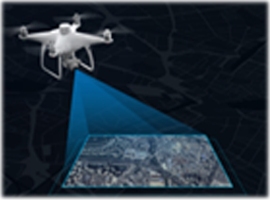
o UAV (Drone) Surveying & Mapping Services.
o Photogrammetric Mapping Services.
o XYZ Matching Services - Point Cloud/ECW.
o Point Cloud Services (LAS/LAZ).
o 2D Mapping on Satellite Imagery Services (Raster to Vector Digitisation).
o GIS Related Projects.
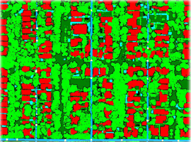
Advanced classification (Ground, Buildings, Roads, Power lines, Manmade Features, Vegetation, Etc.)
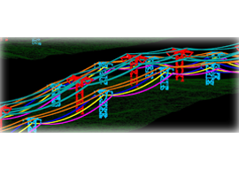
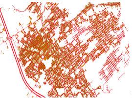
Power Line Classification and Vectorization.
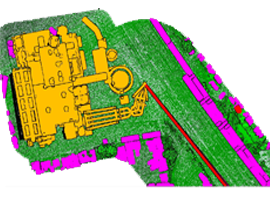
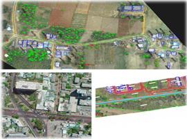
2D/3D Mapping (Topographical Mapping).
Rural & Urban Development Mapping.
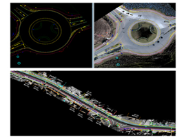
Road, Highway, Railway and Power line Corridor Mapping.
2D / 3D Mapping (Feature Extraction from LAS/LAZ files).
Road, Highway and Railway Corridor Mapping & Utility Mapping.
Rural & Urban Development Mapping.
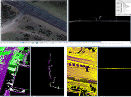
Point Cloud Classification (Classification of Bare Earth and Vegetation, Buildings, Bridges, manmade, Etc.)
DEM, DTM, DSM, TIN, Contour and Model Key Points Generation from LAS/LAZ files.
Break lines, Cross Section and L-Section (Profile Plans).
AutoCAD Drawings with Proper Layers, Codes and Blocks for each and every Element.
We process the captured UAV images, using the leading photogrammetry software to transform into accurate and Geo-referenced digital spatial models, with the help of given Ground Control Points (GCP).
Typical outputs that are created include 3D point clouds, 3D mesh, and Orthomosaics. We use the outcome of the processed data to digitize & extract features and perform point cloud classification where they can be processed and analysed to get final output in the form of digitized 2D/3D Mapping.
Filed Surveying.
Data Processing.
Accuracy Assessment.
Data Cleaning.
Point Cloud Generation.
Orthomosaic Generation.
Digital Surface Models (DSM).
Digital Terrain Models (DTM).
3D Textured Mesh.
Contour Creation.
Feature Extraction on GEOTIFF/ECW files (Raster to Vector Digitisation).
Ortho-Rectification/Geo-Referenced Images.
Point Cloud Classification (Bare Earth and Non-Ground Classification of LAS files).
DEM, DTM, DSM, TIN, Contour and Model Key Points Generation from LAS files.
Cross Section & L-Section & Break line collection (Profile Plans).
AutoCAD Drawings with Proper Layers, Codes and Blocks for each and every Element.
5M Geospatial Technologies provides a wide range of high-quality professional and satellite mapping services. Our Geospatial experts frequently merge multiple sources of imagery together to provide customized coverage of territories, as per client requirements. By which we obtain a seamless, colour-balanced, tonally balanced, and Geo-referenced or Ortho-rectified image file, ready to use in any mapping or imaging software. We have experience using aerial photography and satellite imagery for project planning and assessment.
Matching of Point Clouds (LAS/LAZ Files) for Given GCP Points.
Flightline/Tieline Matching by using trajectory files.
XY Shift Matching, Z (Elevation Matching) on Point Cloud Data (LAS/LAZ Files).
Ortho-Rectification of ECW/GEOTIFF Files (XY Matching).
Point Cloud Classification (Ground Classification / Feature Classification).
Powerline Classification and Vectorization (Powerline Stinging).
DEM/DTM/DSM/TIN/CONTOUR Data Generation.
Point Cloud Matching for Flightline/Tieline and GCP points.